Image Caption
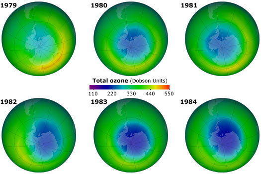
These maps, generated from NASA satellite data, show the growing hole in the ozone layer over Antarctica for each October from 1979 to 1984.
Image use policy: For non-commercial, educational purposes, this image may be used with a Creative Commons CC BY-NC-SA 4.0 license. Please credit as follows: © University of California Museum of Paleontology, Understanding Science, www.understandingscience.org
See where this image appears on the Understanding Science website »
To save: 1) Click on image for the full-size version, 2) right-click (Windows) or control-click (Mac) on the image, and 3) select "Save image."